Soil maps for Filipino farmers – a case study for how to make good science work in partner countries
It’s hard to cross a road in the Philippines – let alone create high resolution soil maps. Yet Australian and Filipino researchers have found a way, distributing maps and techniques to agricultural professionals in the archipelago nation.
The land suitability maps are helping rural people in the Philippines create sustainable livelihoods, grow nutritious food for their communities and prevent water pollution, flash flooding and landslides. For example, the Cabulig River gorge in the north of Mindanao Island were identified as a priority area for agroforestry following analysis of the maps with local villagers, farmers, hydropower companies, plantation companies as well as local, provisional and national government representatives.
The ACIAR project is an insightful case study for how to make good science work in a partner country. The Australian and Filipino researchers recently published their methods and learnings in a paper in the journal Geoderma. We recently chatted with Project Leader and CSIRO scientist Dr Anthony Ringrose-Voase to clarify the lessons learned:
1. Leap-frog practical limitations
Soil labs, soil data and experienced soil surveyors are scarce in the Philippines. The intuitive solution would be to “build from scratch” – slowly develop standard soil labs, grind out conventional soil surveys and teach basic soil and statistical knowledge. However, the Australian and Filipino researchers combined their minds and the latest technology to implement a more effective and fast-acting approach:
- They developed simple soil sampling protocols that minimize the need for experienced soil surveyors.
- They purchased and calibrated the latest soil analysis tools that can rapidly collect soil data without the need for chemical laboratories to analyse the majority of the samples.
- They created user-friendly software programs that automate highly technical processes. This enables local land managers to focus on using the soil maps (not just developing them).
The researchers used technology and innovation to ‘leapfrog’ immovable practical challenges without compromising research quality.

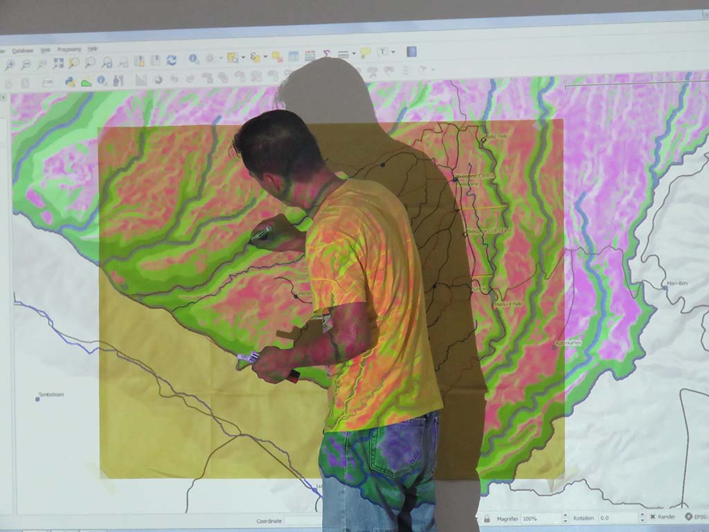
Remar Lozarito from Claveria Local Government Unit working on land use plans with villagers from Barangay (village) Malagana during a participatory land use planning workshop using information from the soil survey of Cabulig Watershed, Nov 2016.
2. Make the most of labour affordability
We often think about the practical challenges for developing countries but there are also practical opportunities. As Anthony explained, “in Australia we are forced to do capital-intensive, low labour science but in developing countries you can flip that and do labour-intensive, low capital science”. For example, visible-near infrared (vis-NIR) spectroscopy and mid infrared (MIR) spectroscopy are two cutting-edge soil analysis tools. These gadgets can rapidly measure many important soil properties (e.g. clay content, pH, total Carbon, total Nitrogen, CEC) but not everything (e.g. plant-available Phosphorus). MIR is generally more accurate than vis-NIR but Australian soil scientists mostly use vis-NIR because it requires less labour. Labour costs are less limiting in the Philippines so the researchers were able to use MIR. This delivered accurate results, rural jobs and an opportunity to promote workplace health and safety.

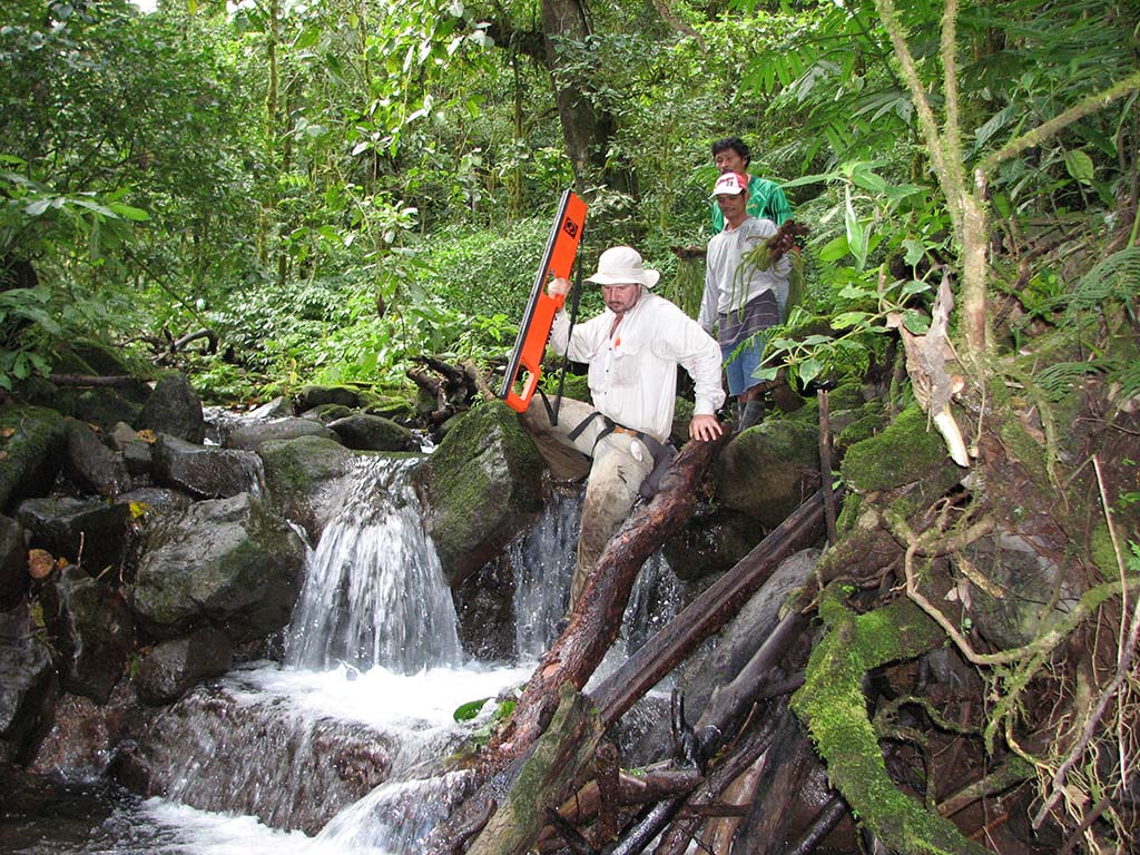
Dr Mark Thomas, CSIRO, accessing a remote area of the Cabulig Watershed in Northern Mindanao on the slopes of Mt Sumagaya for soil survey. Nov 2011.
3. Give ownership to locals
There is always a risk that partner country organisations will not implement the findings of ACIAR projects. The Australian and Filipino researchers involved a wide range of farmers, government organisations and extension professionals from the beginning of the project. These locals were keen to utilise the results because they were given ownership of the project and its success. In Anthony’s words, “when people have busted a gut to create these soil maps they are more likely to use them”.

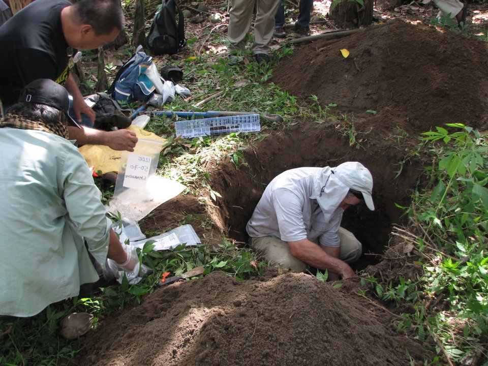
Dr Gerard Grealish describing and sampling a soil profile in San Nicolas near Jasaan in the Cabulig Watershed, Mar 2012.


